Seoraksan
🎬 Watch videosToday's Videos
News




Seoraksan Hiking Trails, Gwongeumseong Cable Car and Entry Hours (Autumn 2026)
Seoraksan is a national park spread across Sokcho, Inje, Goseong and Yangyang in Gangwon. It became Korea's fifth national park in 1970 and a UNESCO Biosphere Reserve in 1982. Its highest peak, Daecheongbong, stands at 1,708 m, the third highest in South Korea after Hallasan and Jirisan. The park splits into three areas with different trailheads and character: Outer Seorak, reached from Sogongwon in Sokcho; Inner Seorak, around Baekdamsa Temple in Inje; and South Seorak, on the Hangyeryeong and Osaek side. Covering two of them in one day is hard, so pick the trailhead first and the rest of the plan follows.
Distances and times below come from the Korea National Park Service (KNPS) Seoraksan trail guide. Cable car fares come from the Seorak Cable Car website.
At a glance
| Item | Details |
|---|---|
| Location | Sokcho, Inje, Goseong and Yangyang, Gangwon State |
| Highest peak | Daecheongbong, 1,708 m |
| Main trailheads | Seorak-dong Sogongwon (Outer Seorak), South Seorak Visitor Center (Osaek), Hangyeryeong, Baekdam (Inner Seorak) |
| National park admission | None |
| Cable car | Sogongwon to Gwongeumseong, adult round trip KRW 16,000 (on-site tickets only) |
| Easiest walk | Sogongwon to Biryong Falls; the first 1.2 km or so is passable with strollers and wheelchairs |
| Shortest summit route | Osaek to Daecheongbong, 5.0 km one way, about 4 hours |
| 2026 foliage | First color September 28, peak October 16 (Korea Meteorological Administration) |
| Contact | Seoraksan National Park Office +82-33-801-0900 |
Choosing a trail: official distances and times
These are KNPS one-way figures. Add your own time for the descent. On autumn weekends, stairs and boardwalks back up, so expect to take longer than the table shows.
| Trail | Route | Distance | Time | Notes |
|---|---|---|---|---|
| Biryong Falls and Towangseong Falls Observatory | Sogongwon → Biryong Falls → observatory | 2.4 km + 0.4 km | 1 hr + 30 min | The last 400 m is stairs |
| Biseondae and Geumganggul Cave | Sogongwon → Biseondae → Geumganggul | 3.0 km + 0.6 km | 1 hr 20 min + 40 min | Gentle path beside the stream up to Biseondae |
| Ulsanbawi | Sogongwon → Heundeulbawi (Gyejoam) → Ulsanbawi | 2.8 km + 1.0 km | 1 hr + 1 hr | About 7.6 km and 4 hours round trip; the last 1 km is steep steel stairs |
| Cheonbuldong Valley and Yangpok Shelter | Sinheungsa → Biseondae → Yangpok Shelter | 6.5 km | 3 hr 10 min | Valley route right among Outer Seorak's autumn color |
| Jujeongol | Osaek Mineral Spring → Yongso Falls | 3.2 km | 1 hr | Mostly boardwalk and gentle, 2 hours round trip |
| Daeseung Falls | Hangyesanseong Ranger Station ↔ Daeseung Falls | 1.8 km round trip | 1 hr 20 min | An 80 m waterfall |
| Daecheongbong (Osaek) | South Seorak Visitor Center → Daecheongbong | 5.0 km | 4 hr | Shortest, but the stone steps keep climbing; 8 hours round trip |
| Daecheongbong (Hangyeryeong) | Hangyeryeong → Seobuk Ridge → Daecheongbong | 8.3 km | 5 hr 20 min | Continuing to Sogongwon makes it 19.3 km and 12 hours |
| Bongjeongam and Daecheongbong (Baekdam) | Baekdamsa → Bongjeongam → Daecheongbong | 10.6 km + 2.3 km | 4 hr 30 min + 1 hr 40 min | Whole route 23.9 km, planned as two days |
| Gongnyong Ridge | Sogongwon → Biseondae → Madeungnyeong → Gongnyong Ridge → Osaek | 19.1 km | 14 hr 40 min | For experienced hikers; plan a shelter night |
For a first visit with half a day, Biryong Falls and Biseondae are the easiest picks. On Ulsanbawi the last kilometer is all stairs, and fitness makes a big difference there. Daecheongbong takes a full day from any side. Plan a pre-dawn start and check the return bus times before you go.
Gwongeumseong Cable Car: as of October 26, 2026
The cable car runs 1,128 m from the Sogongwon station to the upper station at Gwongeumseong (699 m above sea level), about 5 minutes each way. There is no hiking trail down, so only round-trip tickets are sold. There are no advance reservations; tickets are sold on the day at the first-floor counter.
| Category | Round-trip fare |
|---|---|
| Adult (middle school and older) | KRW 16,000 |
| Child (37 months to elementary school) | KRW 12,000 |
| Infant (under 36 months) | Free |
| National merit holders, severe disability (adult) | KRW 13,000 |
| Seniors (65 and older) | KRW 14,000, but no discount from September 19 to November 15, 2026 |
- Operating hours for October 26 were posted as 07:30 to 17:00. Hours change daily with the season and weather, so check the top of the website on the day.
- At 1:27 p.m. that day, the website's live board showed a 2 hour 27 minute wait. On foliage weekends you may wait hours even after buying a ticket. One approach is to buy early in the morning and visit Biryong Falls or Sinheungsa while you wait.
- If wind or bad weather stops the cable car, unused tickets are fully refunded. Refunds are full up to 10 minutes before boarding; after that, refunds or time changes cost 20%.
- If you ride the last car up, you only get about 20 minutes at Gwongeumseong. Strollers are not allowed on board; there is free stroller storage outside the station. Wheelchair users can reach the boarding floor by elevator.
- The cabins have no heating or air conditioning. The wind on top of Gwongeumseong gets cold in late autumn, so bring a jacket.
Entry hours and trail closures
Seoraksan sets entry hours for its trails. Under the notice effective July 11, 2026, summer hours (April to October) differ from winter hours (November to March). Winter hours apply from November 1.
| Starting point and direction | Summer (Apr–Oct) | Winter (Nov–Mar) |
|---|---|---|
| South Seorak (Osaek) → Daecheongbong | 03:00–12:00 | 04:00–11:00 |
| Hangyeryeong → Hangyeryeong junction | 03:00–12:00 | 04:00–10:00 |
| Biseondae → Yangpok, Huiungak | 03:00–14:00 | 04:00–12:00 |
| Biseondae → Madeungnyeong | 03:00–11:00 | 04:00–10:00 |
| Baekdam → Suryeomdong Shelter → Socheong | 03:00–14:00 | 04:00–13:00 |
| Heullimgol → Yongso Falls | 03:00–14:00 | 04:00–14:00 |
| Sogongwon ↔ Ulsanbawi, Biseondae, Towangseong Falls Observatory, Gwongeumseong | No hiking from sunset until 2 hours before sunrise | Same |
- Once the time on the right has passed, you cannot enter in that direction. Entering during closed hours brings a fine of KRW 200,000 for a first offense, KRW 300,000 for a second and KRW 500,000 for a third.
- Hikers with shelter bookings get an extra 1 to 2 hours. For example, at Biseondae, Yangpok Shelter guests get 2 extra hours and Huiungak Shelter guests get 1.
- Heullimgol requires a trail reservation. The notice lists reservation hours of 09:00 to 14:00 for October and November, and 08:00 to 15:00 during the October peak season.
- High-altitude trails close during the autumn wildfire prevention period. In 2025 they were closed from November 15 to December 15, covering Gongnyong Ridge and the routes from Hangyeryeong and elsewhere up to Daecheongbong, while lower trails such as Biseondae, Ulsanbawi, Towangseong Falls Observatory and Jujeongol stayed open. As of October 26, the 2026 autumn closure notice had not yet been posted on the Seoraksan park notices page. If you plan to hike in November, check again before you leave.
- On October 26, the KNPS trail control page listed Seoraksan as "normal." That changes quickly when heavy rain or snow warnings are issued.
Autumn foliage 2026: this year's record
- First color on September 28: announced by the Gangwon Regional Meteorological Administration. That matched the long-term average and was four days earlier than 2025 (October 2). The Korea Meteorological Administration counts first color when 20% of the mountain, starting from the summit, has turned.
- Peak on October 16: reported by Money Today on October 18, citing Korea Meteorological Administration data. That was one day ahead of the average (October 17) and earlier than 2025 (October 24). Peak means 80% of the whole mountain has turned.
- Forecast vs. observation: The Korea Forest Service's 2026 foliage peak forecast map, released in September, put Seoraksan's peak at October 20. The Forest Service counts the peak once at least half of the trees have turned, so its dates differ from the Meteorological Administration's.
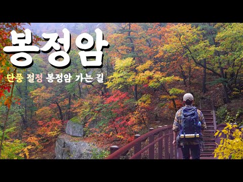
- Color starts on the summit ridges and works down into the valleys. The Seoraksan National Park Office posted photos of Cheonbuldong Valley foliage on October 19. By the last week of October many high-altitude leaves may have fallen. The remaining color is more likely in the lower valleys, such as Biseondae, Cheonbuldong and Jujeongol.
- Foliage-season traffic measures (October 3 to November 8): 27 staff work daily between the Osaekryeong pass and the South Seorak Visitor Center, enforcing parking rules. Between Heullimgol and the South Seorak Visitor Center, vehicles may only stop briefly. Large charter buses must use the Osaek Gwanteo public parking lot. Illegal parking on the Osaek side can draw fines under both the Road Traffic Act and the Natural Parks Act. In Seorak-dong, a free shuttle bus runs between the B and C district parking lots and Sogongwon.
For other mountains' peak dates and the nationwide picture, see Autumn Foliage Spots.
Getting there and parking
Public transport
- Seoul → Sokcho: about 2 hours 30 minutes by express bus or 2 hours 10 minutes by intercity bus, roughly every 30 minutes.
- Sokcho city → Sogongwon: take city bus 7 or 7-1 to the last stop, Seoraksan parking lot. The cable car station is a 5-minute walk from the Sogongwon entrance.
- For Osaek (South Seorak) and Hangyeryeong, check the Yangyang and Inje routes separately. Buses are infrequent, so if you finish somewhere other than where you started, sort out your ride back first.
By car
- Sogongwon has no dedicated cable car parking. Use the paid Sinheungsa parking lot (parking office +82-33-636-4050). The official websites do not list a fee table, so follow the on-site rates.
- On foliage weekends, when the Sogongwon access road fills up, cars are held back and directed to the Seorak-dong B and C district lots and the shuttle. Parking there from the start and taking the shuttle saves time.
- Roadside parking in Osaek is enforced. Look for the public lots first.
On the Inner Seorak side, regular cars cannot drive from Yongdae Village to Baekdamsa. On foot it is 6.5 km, about 1 hour 30 minutes. The valley itself is covered in Inje Baekdam Valley.
Season by season
| Season | Highlights | Watch out for |
|---|---|---|
| Spring (Apr–May) | Fresh green, full streams | High trails close during the spring wildfire prevention period |
| Summer (Jun–Aug) | Cheonbuldong and Jujeongol valleys | Rockfall and trail closures after heavy rain |
| Autumn (Sep–Nov) | Foliage, views of Gongnyong Ridge | Parking and cable car waits; shorter entry hours from November |
| Winter (Dec–Feb) | Snow scenery, Gwongeumseong | Crampons needed; closures during weather warnings |
What to bring
- A headlamp and spare batteries if you start a summit hike at 3 or 4 a.m.
- A windbreaker and a warm layer. Daecheongbong and Gwongeumseong are much colder than the valley floor
- Water and snacks. There are no shops on the summit ridges. The Gwongeumseong station has a snack bar and a coffee shop
- Hiking boots and poles for the stairs on Ulsanbawi and Daecheongbong
- Your national park booking confirmation if you are staying in a shelter. Socheong, Huiungak, Yangpok and Suryeomdong shelters cost KRW 20,000 on weekdays and KRW 30,000 on weekends and in peak season
- A bag for your trash. The whole of Seoraksan National Park is non-smoking, and bringing in flammables such as lighters is not allowed
Pairing with Sokcho and Yangyang
Most people hiking Outer Seorak stay in Sokcho. After coming down, a common route is dakgangjeong (sweet fried chicken) or seafood at Sokcho Jungang Market, then Cheongchoho Lake or the small hand-pulled ferry at Abai Village. If you come down on the Osaek side in Yangyang, Naksansa Temple and the coast are easy to add. In summer, you can continue to Yangyang Surfing. If you plan to drive the foliage roads, 2026 Gangwon Autumn Drive covers routes over Hangyeryeong and Misiryeong. Other Gangwon spots are under Gangwon, and other mountains under Hiking.
FAQ
Q. Can I reserve cable car tickets in advance? A. No. Tickets are sold only at the on-site counter on the day. In foliage season, go early in the morning and get a ticket with a boarding time.
Q. Can I walk down from Gwongeumseong? A. There is no trail down. You ride the cable car both ways.
Q. Can I do Daecheongbong as a day hike? A. The Osaek route is about 10 km and 8 hours round trip. You cannot start from Osaek toward Daecheongbong after 12:00 in summer hours, or after 11:00 from November.
Q. Where should I go with children? A. The Sogongwon to Biryong Falls path. The first 1.2 km or so is passable with strollers and wheelchairs. Jujeongol in Osaek is also easy walking, with plenty of boardwalk.
Q. Can I hike Gongnyong Ridge or Daecheongbong in November? A. Once the autumn wildfire prevention closure is announced, the high trails close. In 2025 they closed from November 15. Check the 2026 notice before planning.
Q. Is there a national park entrance fee? A. There is no national park admission fee. Parking, the cable car and shelters are paid separately.
Sources
The sources below are in Korean.
- KNPS Seoraksan trail courses (distances and times): https://www.knps.or.kr/front/portal/visit/visitCourseSubMain.do?parkId=120400&parkNavGb=guide&menuNo=7020093
- KNPS Seoraksan fees (shelters, peak periods): https://www.knps.or.kr/front/portal/visit/visitCourseMain.do?parkId=120400&menuNo=7020093
- Seoraksan entry hours notice (No. 2026-24, effective July 11): https://www.knps.or.kr/front/portal/open/pnewsDtl.do?menuNo=8000517&pnewsId=PNEWSM034180&searchParkId=120400&pnewsGrpCd=PNE01
- KNPS trail control status: https://www.knps.or.kr/front/portal/safe/acsCtrList.do?menuNo=8000340
- Seorak Cable Car visitor guide (fares, boarding, directions): https://www.sorakcablecar.co.kr/guide
- Gangwon Regional Meteorological Administration press release, Seoraksan first foliage (2026-09-28): https://www.weather.go.kr/kma/flexer/html/press/2026/09/28/ATC202609281120132_a20539d2-b72e-4dbc-af49-5aa5ccd041e8.hwp.files/Sections1.html
- Money Today, Seoraksan foliage peak on October 16 (2026-10-18): https://www.mt.co.kr/society/2026/10/18/2026101809303813109
- Kangwon Ilbo, Korea Forest Service 2026 foliage peak forecast map: https://kwnews.co.kr/article/20260927500986
- Maeil Shinmun, difference in peak criteria between the Meteorological Administration and the Forest Service (2026-10-16): https://www.imaeil.com/page/view/2026101607053707778
- Seoul Shinmun, Seoraksan foliage-season traffic measures (2026-09-30): https://www.seoul.co.kr/news/society/2026/09/30/20260930500136
- Kyunghyang Shinmun, 2025 autumn high-altitude trail closures (2025-11-06): https://www.khan.co.kr/article/202511061252001
Information checked: October 26, 2026.
Keep exploring
More in this category
Parent category
🗺 Map
Recommended Videos
News